ESA usually distributes data in levels 0, 1 and 2; level 0 corresponds to raw data, level 1 to acquired data in physical units, level 2 are values of the parameter which constitutes the scientific objective of the experiment. Level 3 are extrapolated or assimilated data giving global maps of the studied phenomena. Level 4 are high level data which can be directly presented to the general public; an example are the animated weather maps presented on TV. Levels 0 and 1 are the most susceptible to be the source of original research while level 2 values, if distributed by a space agency, have the advantage of formal quality control while equivalent products developed by scientists are controlled by peer review during the publication process.
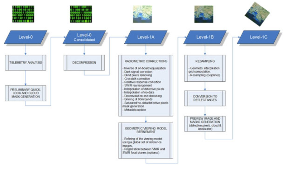 Fig. 2: Data levels for the ESA Sentinel-2 satellite ,essentially a multispectral imaging earth observation satellite (https://sentinel.esa.int/web/sentinel/user-guides/sentinel-2-msi/processing-levels).
Sentinel satellites are the flagships of the COPERNICUS EU-ESA programme of earth observations. This diagram shows the path from raw data to level-1C, optimised for science analysis. (ESA document).
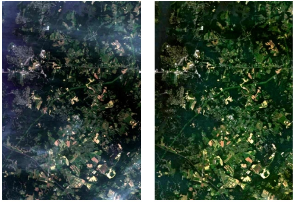
Fig. 3: An example of comparison between a level 1-C Sentinel 2 scene and a level 2 product of the same scene: the BOA (Bottom Of the Atmosphere) radiance. (ESA document, https://sentinel.esa.int/web/sentinel/user-guides/sentinel-2-msi/product-types/level-2a). This product is derived from processing algorithms developed in close cooperation with scientists and validated by ESA . Level-2A products are not systematically generated at the ground segment. Level-2A generation can be performed by the user through an ESA provided toolbox using as input the associated Level-1C product. Other treatments for the same purpose of the same image are possible but become scientific products and are validated by peer review in the publication process.
Conclusions
This phasing and data classification provides an clearway to follow the different phases of the project and a first structure for data distribution and archiving.